Western Cape, VREDENDAL district, Strandfontein, Hollebak 270, Fryersgrove, farm cemetery

2009-05-04 9 images Share: , ,
View Slideshow
Cemetery information:- This cemetery is adjacent to the Strandfontein turn off, on the road from Lutzville via Papendorp to Doring Bay. In the early years Papendorp was called Fishwater eGGSA captions done by Wilna Eygelaar. Information also available on the GGSA Cemetery DVD:- Cemetery ID: 2863 Names in cemetery: 1 Information submitted by: Wilna Eygelaar Google Earth Project Information:- GPSID: 3429 GPS: -31 45.323, 18 14.034
1. Overview on cemetery from the road
2. Entrance to the cemetery
3. Plaque at the left side of the entrance
4. Plaque at the right side of the entrance
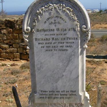
5. Unmarked grave at Katharine Elizabeth Fryer's right side
6. Unmarked grave at Katharine Elizabeth Fryer's left side
FRYER Katharine Elizabeth -1900